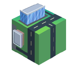
SiteMap enables clients to visualize facility data with the ease of a few clicks, allowing them to understand their facility infrastructure information more efficiently. In addition to providing a map database and utility information, SiteMap also serves as a common repository for facility artifacts. The value of SiteMap is that it serves as a geospatial solution and functions as a digital storage space for blueprints, as-built drawings, maintenance logs, permits, and more. Additionally, it can geolocate every piece of information, allowing the content to be found and cross-referenced online at any time. SiteMap allows clients to sort site locations and create groups based on this material for more efficient project management.
Gone are the days of lost and disparate facility maps and infrastructure data.
Imagine having the most organized facility planning room available to anyone who needs it at any time; this is SiteMap.
YOUR ENTIRE CAMPUS
-
ACCURATELY MAPPED
-
DIGITALLY STORED
-
EASILY ACCESSIBLE
- SECURE CLOUD-BASED DATA STORAGE
- UPLOAD AND STORE SITE RECORD, HISTORICAL AND AS-BUILT DRAWINGS
- ATTACH PHOTOS, VIDEOS, GPR DATA, AND OTHER IMAGES TO PLANS
- ACCESS TO GPRS GENERATED FINDINGS
- SECURE CLOUD-BASED DATA STORAGE
- UPLOAD AND STORE SITE RECORD, HISTORICAL AND AS-BUILT DRAWINGS
- ATTACH PHOTOS, VIDEOS, GPR DATA, AND OTHER IMAGES TO PLANS
- ACCESS TO GPRS GENERATED FINDINGS
- CLIENT ABILITY TO IMPORT EXISTING INFRASTRUCTURE DATA
- SECURE CLOUD-BASED DATA STORAGE
- UPLOAD AND STORE SITE RECORD, HISTORICAL AND AS-BUILT DRAWINGS
- ATTACH PHOTOS, VIDEOS, GPR DATA, AND OTHER IMAGES TO PLANS
- ACCESS TO GPRS GENERATED FINDINGS
- SECURE CLOUD-BASED DATA STORAGE
- UPLOAD AND STORE SITE RECORD, HISTORICAL AND AS-BUILT DRAWINGS
- ATTACH PHOTOS, VIDEOS, GPR DATA, AND OTHER IMAGES TO PLANS
- ACCESS TO GPRS GENERATED FINDINGS
- CLIENT ABILITY TO IMPORT EXISTING INFRASTRUCTURE DATA
Subsurface infrastructure information can be incongruent and siloed. For decades, companies have been trying to reimagine or adapt silo structures within their organizations. As facility managers, one of the most crucial tasks is to prepare their teams, subordinates, and superiors to overcome these destructive organizational barriers.
It is common for facilities to have disorganized infrastructure information. Often facility artifacts can be sequestered to an individual’s office or spread out among multiple locations if not lost altogether. Additionally, subsurface infrastructure information can be unknown to most staff except by one or two individuals. SiteMap brings all that information into a single source that is accessible when you need it, updateable, and collaborative.
Collaboration in Real-Time
SiteMap is a collaborative tool that updates in real-time, which means you don’t have to wait to get your projects moving. Once GPRS finishes a project on-site, SiteMap allows our utility locating subsurface infrastructure information to be immediately available for viewing. With cloud-based technology, our clients can comment on, update, and upload pertinent details to communicate to their network more efficiently than ever before.
Empowering to the User
Our goal for SiteMap is to empower the user to manage and use their data in a way that fits their needs. One way we accomplish this goal is by making the SiteMap system scalable. The system’s scalability means that as more information comes to the surface, the system will grow alongside the user. This platform has been designed with integration in mind. Data that has been created in our SiteMap system can be exported out. Our data can be linked out into other GIS. We’ve created outlets for our clients to take the information and utilize it with their platform of choice.
DRONE & AERIAL IMAGERY
Drone imagery is a great way to view up-to-date conditions of your campus with higher spatial resolution than typical satellite generated images. Existing drone imagery and can be added to your map or you can have it collected and uploaded by GPRS.
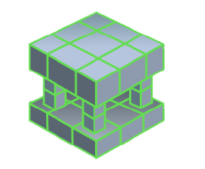
3D DIGITAL SPATIAL INFORMATION
This layer will allow you to digitize your building, automatically create 3D tours, create dollhouse views, create schematic floor plans, view structural reinforcement and utility layouts, and more. This can all be done from the comfort of your own office.
CONCRETE SLAB COMPONENTS & THICKNESS
Structural and utility components within concrete slabs are critical features to map and record prior to construction planning, coring, or saw cutting. SiteMap allows you to view concrete slabs via uploaded structural drawing or even 3D models and tours.
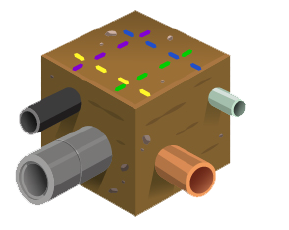
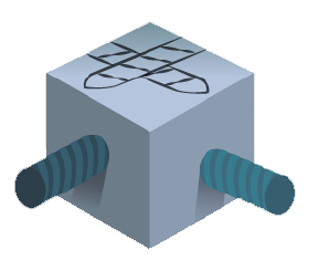
UNDERGROUND UTILITY & PIPE INSPECTION DATA
Knowing the location of underground utilities is crucial in the planning phase and also in the construction phase. The sitemap system will allow you to view the current as-built position of site utilities as well as sewer and manhole video inspection data.
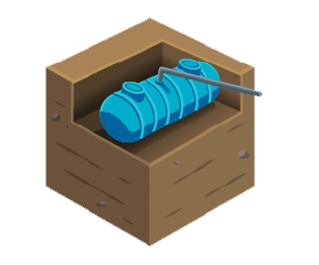
UNDERGROUND STORAGE TANK INFORMATION (UST)
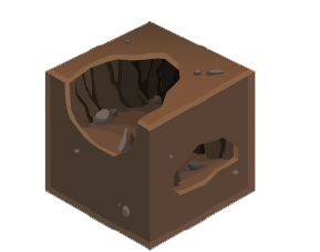
SUBSURFACE VOID INFORMATION
Information regarding the location of subsurface voids can often be discovered and mapped by GPRS. This information, stored in sitemap, can be critical when large machinery such as large cranes and concrete trucks are brought onto your site.

DRONE & AERIAL IMAGERY
Drone imagery is a great way to view up-to-date conditions of your campus with higher spatial resolution than typical satellite generated images. Existing drone imagery and can be added to your map or you can have it collected and uploaded by GPRS.
3D DIGITAL SPATIAL INFORMATION
This layer will allow you to digitize your building, automatically create 3D tours, create dollhouse views, create schematic floor plans, view structural reinforcement and utility layouts, and more. This can all be done from the comfort of your own office.
CONCRETE SLAB COMPONENTS & THICKNESS
Structural and utility components within concrete slabs are critical features to map and record prior to construction planning, coring, or saw cutting. SiteMap allows you to view concrete slabs via uploaded structural drawing or even 3D models and tours.
UNDERGROUND UTILITY & PIPE INSPECTION DATA
Knowing the location of underground utilities is crucial in the planning phase and also in the construction phase. The sitemap system will allow you to view the current as-built position of site utilities as well as sewer and manhole video inspection data.
UNDERGROUND STORAGE TANK INFORMATION (UST)
SUBSURFACE VOID INFORMATION
Information regarding the location of subsurface voids can often be discovered and mapped by GPRS. This information, stored in sitemap, can be critical when large machinery such as large cranes and concrete trucks are brought onto your site.