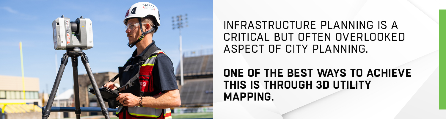
Infrastructure planning is a critical but often overlooked aspect of city planning. In order to ensure that all aspects of a complex facility run smoothly, its infrastructure must be well-designed and properly maintained. One of the best ways to achieve this is through 3D utility mapping.
3D utility mapping is the process of creating a three-dimensional model of an area in order to map out its utilities. This includes things like subsurface utility information, like water and sewer lines and gas lines, as well as map data of structures and electrical wiring therein. By having a 3D detailed map of all the utilities in an area and/or a corresponding CSM (Conceptual Site Model, planners can more easily identify potential problems and develop solutions.
Why 3D Utility Mapping?
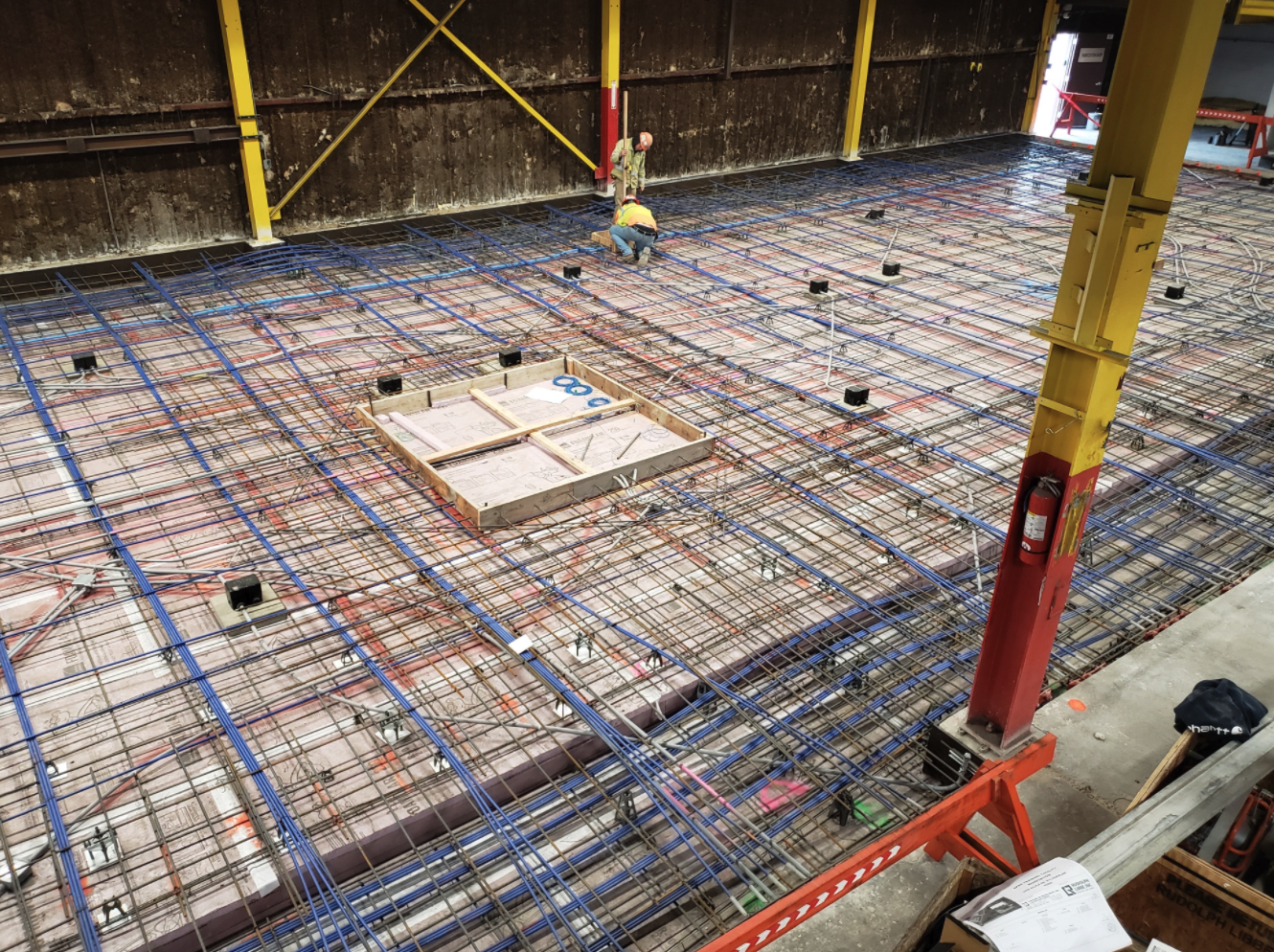
There are many benefits to using 3D utility mapping for infrastructure planning. Typically, 3D utility mapping can be done before a slab pour for architectural structure planning, or before you cut, core, or dig to accurately locate and map existing subsurface utilities and features.
First, it helps planners to get a better understanding of the existing infrastructure. This is especially helpful when planning for new construction or renovations. In fact, over 62% of facility managers, directors, and administrators admit they must look in multiple locations to find subsurface utility information before breaking ground. On average, facility managers are looking at four different locations – resulting in an average increase of 59% in direct and indirect costs. And if subsurface damage occurs, the effect is even worse – a 62% increase in downtime.
Second, 3D utility mapping can help identify potential problems with the existing infrastructure. This is important for both short-term and long-term planning. At times, institutions can have a complex array of underground utilities that contractors are unaware of when they begin new work. And yet, contractors/developers are most commonly responsible for utility strikes (SafetyTalkIdeas). When a utility line strike occurs, each utility strike can result in an average of 2-3 months downtime and $56,000 in cost. By using 3D utility mapping, contractors/developers can be aware of any utilities, have them properly marked, and designate “tolerance zones” around them. In these areas, special methods, such as soft digging tools and even zones of no excavation, exist so as to prevent any utility strikes. Exact designations depend on the types of utilities involved as well as the laws and regulations in your area of development.
Third, these maps and models can help provide data for simulations. This data can be used to test different scenarios and find the most efficient way to solve a problem. With a cloud-based digital plan room, SiteMap can not only demonstrate what your building will look like with drone & aerial imagery and 3D spatial information aboveground, but also demonstrate everything underneath you need to understand for proper planning, including concrete slab components and thickness, underground utility and pipe inspection data, underground storage tank information, and subsurface void information. With all of this information, you can understand exactly what is going to be built in new projects and its effects on your existing infrastructure.
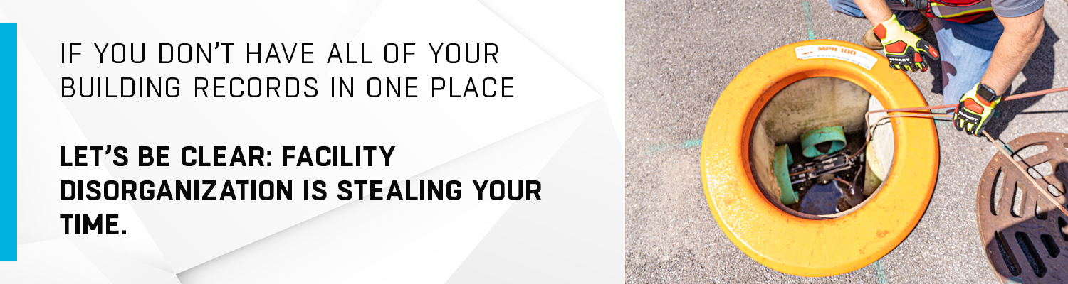
The Importance of Keeping Your Records in One Place
If you don’t have all of your building records in one place, including historical records, site photos, drone footage, digitized footprints, as-builts, and 3D utility maps in one place, let’s be clear: FACILITY DISORGANIZATION IS STEALING YOUR TIME. Even the best 3D utility mapping technology will not help you plan your project more efficiently without the benefit of accurate, easy-to-access building records.
Sitemap.com can help you keep track of your building data, subsurface utility information, and other important documents and files in one central repository. This geospatial solution is easy to use and can be accessed from any computer or mobile device.
With SiteMap, you will have peace of mind knowing that all your facility data is organized and accessible in one place. SiteMap offers many benefits that can save you time and money.
Why SiteMap?
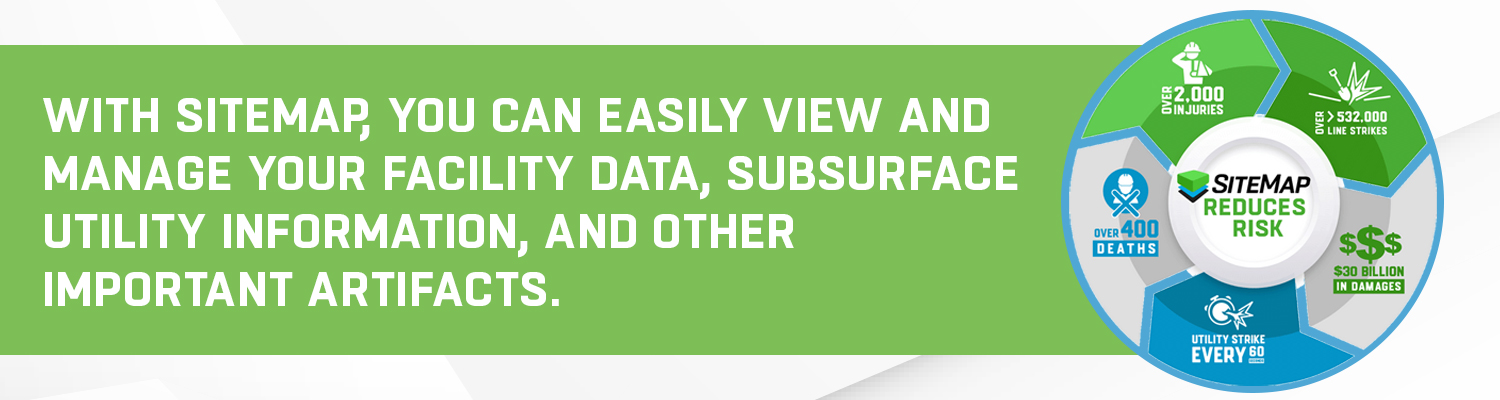
SiteMap is a powerful geospatial infrastructure mapping solution that offers many benefits to customers. With SiteMap, you can easily view and manage your facility data, subsurface utility information, and other important artifacts. This geospatial solution also provides a central and secure repository for all your digital documents and files. In addition,SiteMap is easy to use and can be accessed from any computer or mobile device.
In Summary
3D utility mapping is a powerful tool that can help facility managers, directors, and administrators to better understand and manage the infrastructure of their city. When used properly, it can help identify potential problems and find solutions that are both efficient and effective. If you are involved in city planning, be sure to make use of this valuable resource.