SiteMap consists of a best-in-class GIS software platform and digital tools facility specialists need to execute proper infrastructure asset management practices.
As defined in Infrastructure Asset Management (IAM): Evolution and Evaluation, infrastructure asset management (IAM) is an emerging discipline with the goal of providing “a more systematic approach to managing infrastructure assets… enhanced customer satisfaction, governance and accountability, risk management, financial efficiency, and sustainability.”
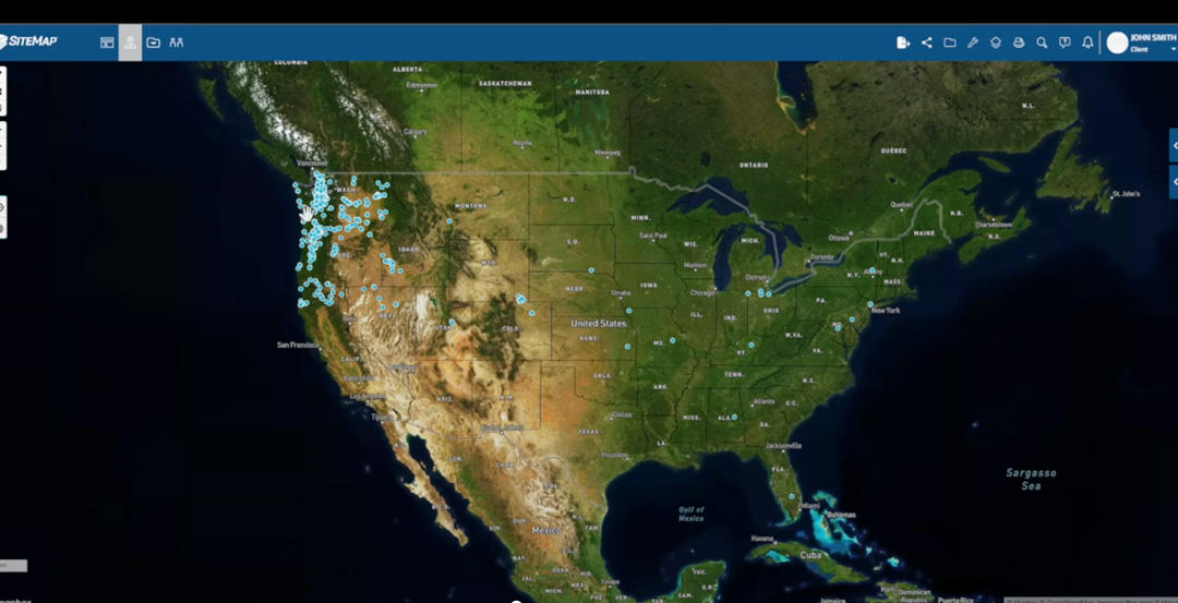
With SiteMap®, powered by GPRS, facility managers are provided with a unique tool that redefines infrastructure collaboration. SiteMap® consists of a best-in-class GIS software platform and digital tools facility specialists need to execute proper infrastructure asset management practices. Within this emerging space, SiteMap®’s innovative visualization capabilities provide infrastructure asset management solutions which are integral to any new project’s success by streamlining communication and data collection in three major ways…
- Ensuring proper documentation with real-time updates
Recently FINCH Brands performed a large-scale survey of qualified respondents within the construction industry. In their study, they reported that 62% of facility managers were frustrated by the fact that they “have to look in many places to find subsurface utility information before breaking ground.”
More traditional methods of filing construction project data can be cumbersome and lead to miscommunication. Constantly re-referencing important documents in separate files is not only a waste of time, but if access to the most recent data is not properly provided, it can also cost a project thousands in funds if damages occur due to operating with inaccurate or outdated records.
SiteMap®’s services can provide you and your team with the solution to this issue. Our innovative software goes above and beyond that of any standard GIS or cloud-based platform. With SiteMap®, you will be able to greatly improve the level of communication, organization, and safety on any project by utilizing our Digital Plan Room. This feature serves as a secure, central repository to upload all necessary facility maps, models, photos, reports, and other necessary as-built documentation in real time. These files can be seamlessly updated and directly linked, cross-referenced, and made viewable within the corresponding Map Viewer feature.
- Detailed and accurate maps and models
Utilizing the Map Viewer feature, the once confusing, counter-intuitive process of viewing maps and models of facility data is completely simplified. Here users can avoid any potential miscommunication or confusion by easily connecting locational data with specific uploaded documents, models, and specifications. Then, facility managers can easily track and geospatially tag maps and models for a more fluid experience when sharing and updating facility utility, subsurface, and structural as-builts. This way, all team members have access to clear, detailed, and accurate measurements of the project site for a full, comprehensive view of the tasks at hand. This avoids clashes, costly change orders, lost time, and accidents.
- All-encompassing representation of your construction site
SiteMap® allows you to fully view the geographic data of any project’s facility features and utilities, both above and below ground, and how those features spatially relate to each other. This is a capability exclusive to SiteMap® because of our comprehensive GPRS inspection services.
GPRS’ ability to completely scan concrete structures in full is not limited by size.
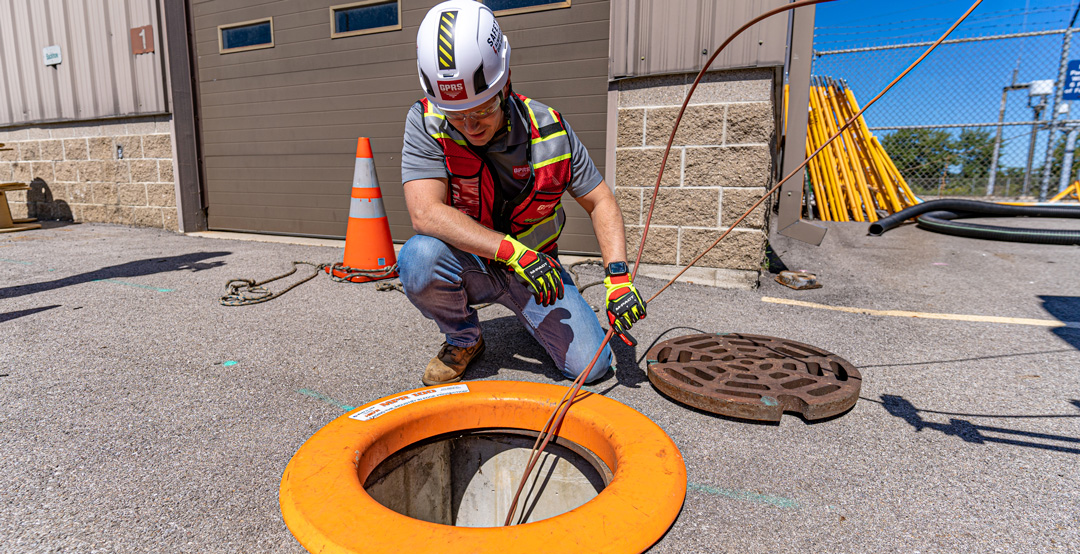
A worker conducts a video pipe inspection at a manhole.
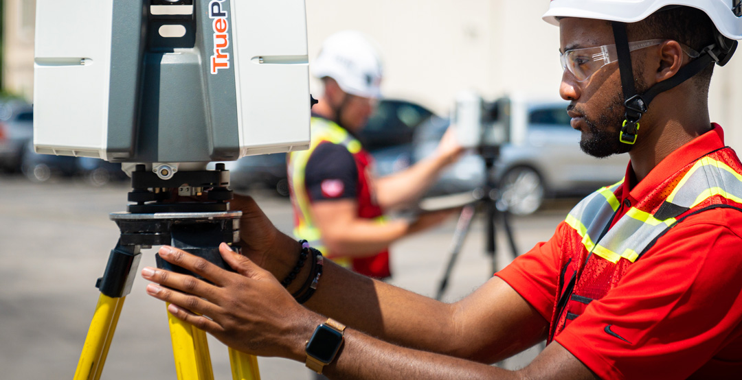
Through 3D laser scanning services provided by GPRS, complete as-builts can be captured with reliable 2-4 mm accuracy.
To provide accurate geographic models, we utilize only the most cutting-edge geographic data collection and mapping software techniques:
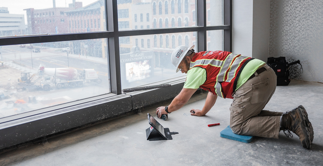
- CONCRETE IMAGING
GPRS’ ability to completely scan concrete structures in full is not limited by size. Therefore, comprehensive structural analysis can be performed on any higher education, manufacturing, high rise, commercial, industrial or other site,, and on any surface, such as concrete slabs, walls, columns, and beams. Our software provides each customer with highly detailed information like key slab information including rebar and post-tension spacing and depth, concrete cover and overlay thickness, concrete thickness, and even dowel placement. Unlike traditional concrete x-ray approaches, our innovative scanning technologies are able to comprehensively evaluate large areas and provide accurate modeling of all findings in detailed field sketches, CAD drawings, and/or 3D models.
- VIDEO PIPE INSPECTION MAPS & REPORTS
Our Video Pipe Investigation (VPI) services utilize industry-leading CCTV cameras to perform sewer pipe inspection services. This NASSCO certified inspection process identifies faults and pipe defects by evaluating underground water, sewer lines, and lateral pipelines. These inspections aid in cross bore prevention and mitigation, sewer and water inspections, lateral inspections, and manhole inspections. With modern surveying technology such as Robotic Crawlers (CCTV), Push Cameras, and Lateral Launch cameras, we are able to collect, map, and provide complete NASSCO certified VPI reports on all pipe defects, their severity, and raw video footage from within the pipe.
- GPRS 3D LASER SCANNING MAPS & MODELS
In the past, in order to attain a set of drawings useful for 3D model creation, an architectural firm would have to be hired to manually collect all required measurements. This process can be extremely costly, time consuming, and due to human error, often inaccurate up to a full foot.
However, through the 3D laser scanning services provided by GPRS/TruePoint, complete as-builts can be captured in a fraction of the time spent on hand measuring with reliable 2-4 mm accuracy. In addition, for most cases, it only takes about 1-2 days for our Project Managers to fully scan a site. From there, our design team can interpret the collected data and generate the comprehensive maps, models, and drawings needed for your project’s success. The customized 3D Laser scanning solutions provided by GPRS/TruePoint and available via SiteMap® can include point cloud creation, 3D BIM modeling, mixed reality development models, and much more
With all the necessary data accurately collected and fully modeled by the techniques described, the results can then be securely stored and easily viewed using SiteMap®’s Map Viewer and Digital Plan Room.
Through this ground-breaking process, communication, and safety on any project are greatly improved, allowing your team to redefine collaboration for the most efficient, cost effective, and safe outcome. .
What can we help you visualize? Learn how SiteMap®, powered by GPRS, can provide complete facility visualization and a unique tool to help you collaborate better by downloading our brochure, and contacting us for a quote today!