The Benefits of Going Paperless: Maintaining Proper Construction Documentation with SiteMap®
Recent reporting by FINCH Brands found that a major pain point for many construction projects and their facility managers is that there are too many files saved/stored in various different places: some hard copies and some digital files. In fact, 62% of facility managers expressed that they are frustrated by the fact that they “have to look in many places to find subsurface utility information before breaking ground.”
 SiteMap, powered by GPRS, empowers you and your team to go completely paperless, and trust in our industry-leading, new, and innovative software capabilities to store your construction project data in one easily accessible, secure location.
Traditionally, filing important construction project data, especially across multiple project teams, would be in printed hard copies filed away in drawers and never scanned, or various digital files on personal hard drives. Even if shared on a cloud-based system such as Microsoft Teams, DropBox, etc., these storage techniques can still be disorganized and often limit the size and type of files that can be uploaded. These methods can be cumbersome, leading to disorganization and miscommunication across teams as they are left to constantly re-reference important documents in separate files.
Not only can this kind of inefficient filing become a major waste of time, but if access to the most recent data is not properly provided, a project can lose thousands in funds or be shut down altogether if major damages occur due to operating with inaccurate and/or outdated records.
Here at SiteMap®, powered by GPRS, we want you and your team to feel totally empowered to go completely paperless, and trust in our industry-leading, new, and innovative software capabilities. With our services, not only will you be provided with the most accurate assessments and 3D models of your current job site conditions, but you will also have access to a secure, digital platform in which you can easily file, reference, and update these documents and how their data relates to each other.
Rather than rely on rough guesswork or slow, inaccurate data storage systems, SiteMap® gives you on-demand, virtual access to fully view every square inch of your facilities above and below ground. Moreover, this modern platform technology can also comprehensively model the following layers of every site and exactly how they relate to each other spatially…
- Drone & Aerial Imagery
Providing a higher spatial resolution than traditional satellite generated images, as well as the ability to provide fully rectified orthomosaic photogrammetry, drone imagery is a great way to view the most up-to-date topical conditions of your site.
Whether or not you have already collected drone imagery for your site, our GPRS services can also provide this service. Either way, this data can be accurately visualized and uploaded easily through SiteMap®.
- 3D Digital Spatial Information
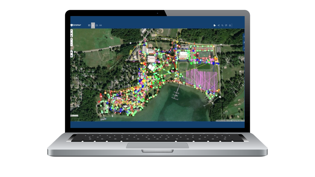
This additional layer of data visualization allows you to further evaluate and digitize every inch of your building’s features. This is done through automatically creating 3D tours, dollhouse views, and schematic floor plans. You can also view crucial structural information such as reinforcement, utility layouts, and much more. Within SiteMap®, this information can then be geolocated, tagged, layered, annotated, and mapped for instant and clear communication across all departments involved.
- Concrete Slab Components & Thickness
SiteMap® also allows you to fully view your site’s concrete slab components and their exact dimensions. By uploading accurate as-built structural drawings and/or 3D models and tours, a fully comprehensive view of all structural and utility components within present concrete slabs can be visualized. This layer of evaluation is especially important as it accounts for critical features that must be fully mapped and recorded prior to any construction planning, coring, or saw cutting can take place. Ensuring accurate and fully updated accounts of this information is one of the most important steps of the visualization processes, as mistakes discovered after breaking ground and drilling into concrete structures are often the most costly and potentially hazardous.
- Underground Utility & Pipe Inspection Data
Another crucial aspect of the planning and construction phases of any project is knowing the exact location of all underground utilities present at a given site. Much like concrete scanning data, this information is also pivotal to ensuring accurate measurements and planning take place before any project breaks ground to ensure safety.
For this reason, SiteMap® allows you to not only view all current as-built positions of your site’s hidden utilities, but also to completely review all sewer and manhole video inspection data. This can even include a fully annotated, NASSCO certified Video Pipe Inspection Report.
- Underground Storage Tank Information (UST)
SiteMap® can also provide accurate and organized documentation of both the horizontal and vertical positioning of your site UST’s. Documentation such as periodic testing or release detection equipment, and inspections of overfill and spill prevention equipment can also be easily stored, shared, and reviewed.
- Subsurface Void Information
Any data regarding the exact location of subsurface voids can be discovered, recorded, and fully mapped through our GPRS capabilities. Once stored within SiteMap®, this data is then made available for easy reference and designated viewing. It is very important to collect these location records prior to using any large machinery on your site, such as large cranes and concrete trucks, let alone before you excavate.
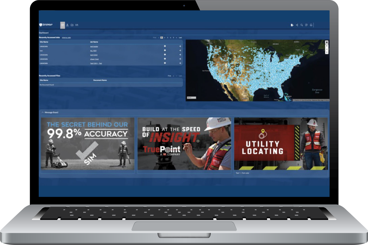
Through these services, facility managers are provided with all the digital tools they need for streamlined infrastructure collaboration. SiteMap®’s innovative visualization capabilities provide solutions which are integral to any new project’s success. This is especially achieved through the use of our 2 key pillars of innovation; our Digital Plan Room and Map Viewer features. Here’s a quick breakdown of how these features can help you and your team collaborate better…
- Map Viewer
Our Map Viewer feature simplifies the process of viewing facility data by allowing users to connect locational data with specific uploaded documents, models, and specifications. With this feature, facility managers can then easily track and locationally designate documents so that they are readily available for future reference. This process creates a more fluid experience when sharing and updating location documents, making Map Viewer an essential tool for any project, saving you and your team time and money while greatly improving overall communication.
SiteMap’s Map Viewer feature simplifies the process of viewing facility data by allowing users to connect locational data with specific uploaded documents, models, and specifications.
Some unique components of our Map Viewer include…
- Viewable, Searchable Maps
- 3D Modeling Viewer
- Tag Site Features to Maps
- Provide a Preliminary Facility or Multi-Site Measurements
- Calculate Estimates of Length and Area
- Digital Plan Room
The Digital Plan Room provides a central repository for all necessary facility maps, models, photos, reports, and other necessary as-built documentation. These uploaded files can then be directly linked, cross-referenced, and fully visualized using the Map Viewer. This safe and secure digital storage space is the most efficient way to organize and share all your project’s relevant facility documents, completely paperless and hassle-free.
Our Digital Plan Room efficiently organizes your most important documents including…
- Underground Utility Locating Data
- Concrete Scanning and Mapping Data
- File Storage For Notes and Specifications
- Historical Drawings
- Site Photos And Annotations
- Drone Footage, Photogrammetry and Orthomosaic Imaging
- Video Pipe Inspection Reports, Photos, and Video
- Water Loss Surveys & Leak Detection Data
- Digitized Blueprints
- Point Clouds & Measurement Data
- Maps & Models
- As-builts of All Varieties
Through SiteMap®’s Map Viewer and Digital Plan Room, you can trust that all the necessary data files for your projects are properly filed and fully modeled for future reference.
This ground-breaking process streamlines communication, improves safety, and minimizes costly change orders on any project. This will allow your team to totally redefine how you collaborate, leveraging the most efficient, cost effective, and safe processes.
Learn how SiteMap®, powered by GPRS, can provide complete facility visualization and a unique tool to help you Visualize the Built WorldTM. Download our brochure, and contact us for a quote today!