Recently FINCH Brands, a premier consumer insights firm, performed a large-scale survey of qualified respondents within the construction industry. All 110 respondents were responsible for making capital expenditure decisions for their facilities and managed one or more building projects across multiple sites. The purpose of this study was to identify the key issues facility managers face today, and what tools they most need to solve them.
![]()
FINCH Brands, a premier consumer insights firm, recently performed a large-scale survey of qualified respondents within the construction industry to identify key issues facility managers face today and what tools they most need to solve them.
SiteMap®, powered by GPRS, provides facility managers with an industry-leading GIS software platform and digital tools to revolutionize collaboration for construction and renovation projects. SiteMap’s unparalleled visualization abilities provide the solutions highlighted in The Finch Reports most recent findings.
FINCH reports that, in the case of collecting and maintaining all necessary ground disturbance documentation, 95% of the facility managers surveyed are “interested in making their policy even more comprehensive.” In addition, facility managers typically “have access to 2-3 types of subsurface utility information,” at once including real time data, printed as-builts/record drawings, digital as-builts/record drawings, ect., and “are storing subsurface information on average in 4 different locations.”
For this reason, 62% of facility managers reported that they “have to look in many places to find
subsurface utility information before breaking ground.” This cumbersome method of filing and referencing important documents is not only a waste of time but, if access to the most recent data is not properly streamlined, it can also cost a project thousands in funds if damages occur due to operating with inaccurate or outdated records.
SiteMap®’s services can provide you and your team with the best possible solutions to this issue. Our innovative software goes above and beyond that of any standard GIS or cloud-based platform. With SiteMap®, you will be able to greatly improve the level of communication, organization, and safety on any project, so you and your team can collaborate better than ever before.
The key to our platform’s success are its two key pillars; Map Viewer and the Digital Plan Room. Within our Map Viewer feature, the process of viewing facility data is completely simplified. Here users are able to easily connect locational data with specific uploaded documents, models, and specifications. Facility managers can then easily use this feature to track and locationally designate documents so they are always readily available for future reference. Rather than multiple storage locations, this feature creates a more fluid experience when sharing and updating facility utility, subsurface, and structural as-builts. In direct support of the Map Viewer tool is our second pillar, the Digital Plan Room. Here, facility managers are provided with a central repository to upload all necessary facility maps, models, photos, reports, and other necessary as-built documentation. Then, these files are directly linked, cross-referenced, and viewable using the Map Viewer feature by appropriately tagging each document with its corresponding location information.
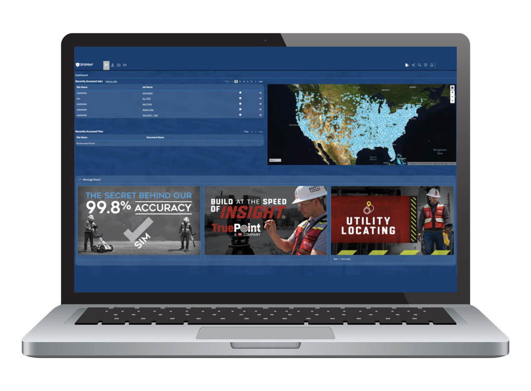
SiteMap®, powered by GPRS, redefines collaboration by providing you and your team one central, easily accessible, secure platform to store all of your facility data.
Through this modern approach, SiteMap®’s digital planning tools can provide you with a fully comprehensive, accurate, 3D model of your entire site both above and below ground. With such innovative capabilities, you and your team can easily access and share all necessary documentation efficiently.
When provided with an overview of the SiteMap® platform, 90% of the facility managers not currently using a cloud-based system for data storage expressed interest in utilizing the it for their future projects. When asked specifically which features of the platform appealed most to them, 60% noted the 3D digital spatial information, i.e., mapping and modeling, and 55% expressed interest in underground utility & pipe inspection capabilities. Key secondary benefits that were identified from this review included comprehensive access, as all the data needed for a project would now be in one place, and the accuracy of information, with the most up-to-date information and real-time data being made available to all team members at once.
When planning your next project, try utilizing SiteMap®, powered by GPRS. Our modern platform greatly improves the communication and safety on any project so you and your team can collaborate better. We aim to support those looking to Visualize The Built World™ by providing them with the clear, comprehensive, and high-resolution maps and models to meet the unique needs of any project, empowering your team to share plans and project goals with subcontractors, designers, engineers, and others using an easy, streamlined approach.
Learn more about how SiteMap®, powered by GPRS, can provide your project with the complete facility visualization it needs to succeed. Download our brochure, and contact us for a quote today!