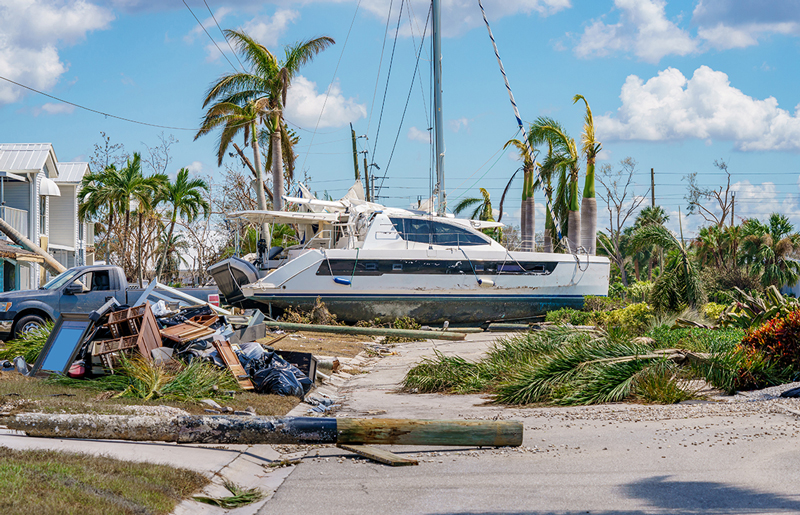
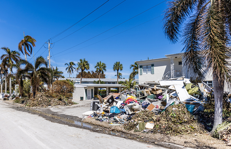
Natural disasters can cause and reveal existing infrastructure damage. Be it from intense hurricane flooding, tornadoes, earthquakes, ect.; cars, boats, and even homes can be displaced for hundreds of miles. As a result, these disasters leave in their wake damaged water pipes, utility lines, and much more.
Natural disasters can cause extensive damage to infrastructure that creates immediate dangers for the surrounding community. With SiteMap, powered by GPRS, facility managers and their teams can quickly obtain and assess detailed maps and models of their reconstruction site.
Such extensive damage to infrastructure creates immediate dangers for the surrounding community. When buildings shift and their structural integrity is compromised, it creates a slew of potential safety hazards including damaged pipes and unexpected voids concealed by concrete. For this reason, it is crucial to obtain an accurate infrastructure assessment of the affected areas as soon as possible. This kind of information is crucial to capturing a full picture of the resulting damage and what next steps must be made to rebuild.
With SiteMap®, powered by GPRS, facility managers and their teams can quickly obtain and assess detailed maps and models of their reconstruction site with the following scanning and mapping services:
- 3D Laser Scanning – Receive existing conditions data quickly and accurately via digital point clouds, 2D drawings, and advanced 3D models. This process is far more efficient compared to traditional manual measurement methods.
- Utility Locating – Using nondestructive ground penetrating radar (GPR), our services are able to identify the exact location of subsurface utilities and how they spatially relate to one another.
- Video Pipe Inspection – We utilize industry-leading video cameras in order to fully inspect underground water and sewer lines. This process provides detailed reports on clogs, leaks, and damaged cross bores, as well as conduct lateral sewer line inspections for subsurface pipes of varying sizes.
- Concrete Imaging – By performing full concrete structural assessments, concealed features such as rebar, post-tension cables, electrical conduit, and voids hidden within concrete structures can be properly located.
Once all necessary measurements are completed, all of the data from these services is captured digitally. This provides a stream-lined, single source of information for current as-is conditions and deficiencies of a given construction site.
Then, utilizing the industry-leading GIS software provided by SiteMap®, facility management is made easier by providing you with the most modern, all-in-one solution to construction management and design. With our services, you can be confident that you and your team are all on the same page, equipped with the most accurate data and up-to-date maps and models for your site. This is why we proudly say SiteMap® offers our customers Collaboration Redefined™.
SiteMap improves the level of communication, organization,and safety on any project, including natural disaster rebuilding efforts.
With SiteMap®, our innovative software goes above and beyond that of any standard GIS or cloud-based platform. With this modern approach to construction project management and collaboration, you will be able to greatly improve the level of communication, organization, and safety on any project.
The success of the SiteMap® platform can be attributed to its two key features: the Map Viewer and the Digital Plan Room. Within our Map Viewer, the process of viewing facility data is made much easier, allowing users to seamlessly connect locational data with corresponding uploaded documents, models, and specifications. Then, facility managers can use this feature to properly track and locationally designate documents so they are easily made available for future reference while remaining secure.
In addition to the Map Viewer, the Digital Plan Room serves as a central repository to upload all necessary facility maps, models, photos, reports, and other necessary as-built documentation. Then, these files are directly linked, cross-referenced, and made viewable using the Map Viewer feature by appropriately tagging each document with its corresponding location information.
Therefore, rather than multiple data storage methods, which can lead to miscommunication and project delays, these features create a more fluid experience when sharing and updating facility utility, subsurface, and structural as-builts. Through this modern approach, SiteMap®’s digital planning tools can provide you with a fully comprehensive, accurate, 3D model of your entire site both above and below ground, which you and your team can easily access and share efficiently.
With our innovative SiteMap® capabilities, you can confidently plan and execute any project knowing our services provide you with the most accurate systems needed to maximize your project’s success. We partner with those who aim to Visualize The Built World™ by providing them with accurate representations of their entire site, both above and below ground.
Learn more about how SiteMap® can support your next project by downloading our brochure, and contacting us for a quote today!