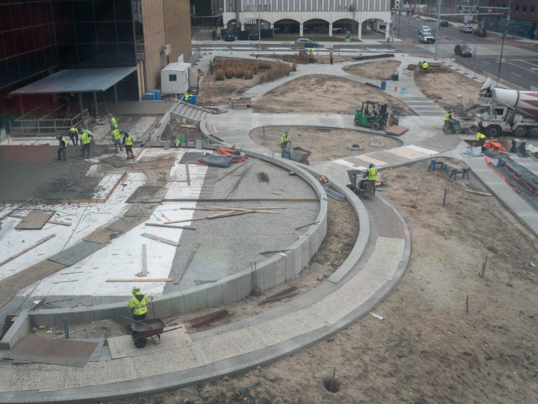
The backlog of construction projects has reached its highest level since 2019, according to recent reporting. Since the second quarter of 2019, construction backlog reached its highest reported level “as contractors with under $30 million in revenue landed new jobs faster than expected, according to Associated Builders and Contractors.”
 The backlog of construction projects has reachedits highest level since 2019. However, many new projects are stumbling to getout of the gate because of major supply chain and labor issues.
The Associated Builders and Contractors (ABC) construction backlog indicator increased to 9.2 months as of November 2022. This is “a 0.4-month uptick from October and a 0.8-month increase from November 2021,” a major jump according to this report. According to ABC’s chief economist, Anirban Basu, “The rise in backlog is remarkable and unexpected.” He elaborates further, explaining that “many predicted that backlog would have dipped by now and that has yet to transpire… What’s more, many contractors expect sales and staffing levels to climb over the next six months, while profit margins are projected to remain stable.”
This trend highlights the widespread growth of construction since the pandemic began. However, despite high demand, many new projects are stumbling to get out of the gate because of major supply chain and labor issues. To alleviate these concerns, at least in part, it is crucial that any new construction project properly equips its teams and subcontractors with the modern tools they need to hit the ground running and avoid costly change orders and further time-consuming delays.
SiteMap, powered by GPRS, can provide complete facility visualization and the unique digital tools your project needs for success.
One of the innovative tools that can be employed to remove confusion is Geographic Mapping Software, which has completely revolutionized the available data visualization capabilities today. Through the combination of innovative data-capturing methodologies and geographic information systems (GIS) technology, sites can be fully scanned from top to bottom to render useful, high-resolution maps and models your team can utilize to accurately assess and collaborate on a project. This technology is vital to maintaining accurate spatial data infrastructure.
With SiteMap®, powered by GPRS, our industry-leading services extend both above and below ground. Our processes provide customers with the accurate data they need for any project vision.
With our innovative platform, important data files and documentation can be stored in the Digital Plan Room feature. This information is then fully visualized and rendered into comprehensive models in Map Viewer. Within Map Viewer, you are able to view the geospatial data of any project’s facility features and utilities, both above and below ground, and how those features relate to each other. This capability is completely exclusive to SiteMap®’s services.
To provide your project with the most accurate geographic models, we utilize modern geographic data collection and mapping software techniques such as…
- Full Digital Reports
In order to properly maintain sewers, it is important to first understand the sewer’s current condition. SiteMap®, powered by GPRS, offers the most modern WinCan methods of reporting Video Pipe Inspection results.
WinCan is our certified Project Managers at GPRS who are able to collect the detailed NASSCO-compliant inspection data needed to provide you with fully comprehensive reports for your project. These reports are then stored and referenced through our SiteMap® Digital Plan Room feature.
- Detailed, Interactive Maps
GPRS Project Managers not only provide complete inspections of the interior water pipe, sewer pipe, sewer lateral and manhole conditions underground, but they can also provide an accurate, interactive map of all their subsurface locations, depths, and how they spatially relate to each other.
In SiteMap®’s Map Viewer, you and your team are provided detailed GPS overlays and CAD files created by our GPRS Deliverables Department after evaluating the raw CCTV film collected during initial inspection.
- Video Inspection Files
All the completed WinCan/Nassco reports from our inspections will contain screenshots of all interior conditions for every pipe segment we inspected. Our Project Managers also provide you with raw video files of the complete inspection for your reference, documentation, and/or any further evaluation.
Our inspection services are then comprehensively mapped and modeled using SiteMap®, powered by GPRS, so you and your team are empowered to successfully execute any project with all the necessary digital construction tools.
We are always striving to help those looking to Visualize The Built World™ by providing high-resolution, accurately detailed, clear maps and models of any site. Learn more about how SiteMap® can help you completely visualize your facility in a new, innovative way. Download our brochure, and contact us for a quote today!