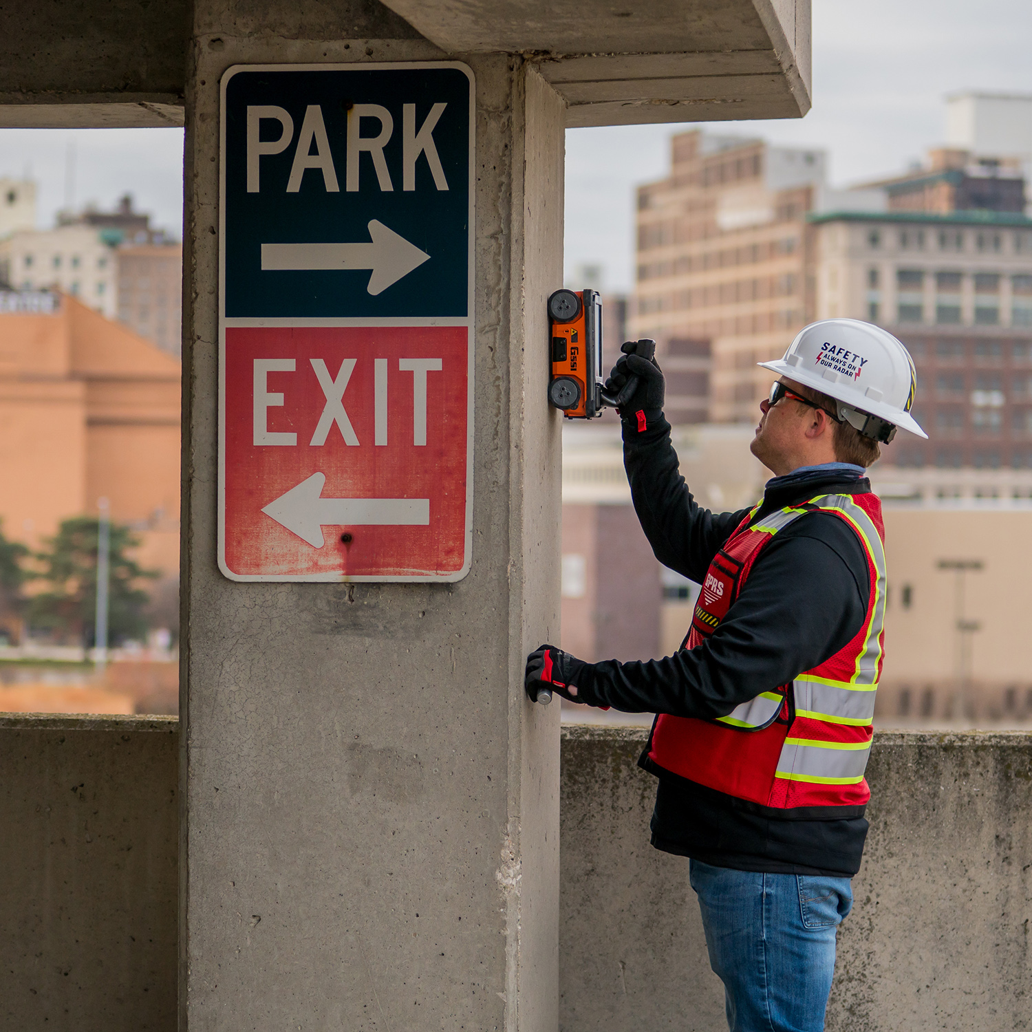
As defined by Perry Testing Ltd, concrete scanning is “the process of scanning concrete using one or more forms of non-destructive technology.” This kind of site evaluation can utilize a number of tools such as cover meters, a ferroscan instrument, ultrasonic scanning equipment, and/or ground penetrating radar (GPR). These tools are capable of penetrating the ground prior digging or drilling in order to locate any objects below at a specified range of depth. Highly experienced, properly trained professionals can then interpret the data collected to determine what anomalies lie beneath the surface, helping you to identify any areas of potential concern before initiating any ground work on a project.
Here at GPRS, we go above and beyond the typical services provided by traditional GPR concrete scanning strategies. Our modern geospatial mapping software, SiteMap®, allows us to provide each customer with easily accessible detailed reports, maps, and 3D models. This includes key slab information like concrete cover and overlay thickness, concrete thickness, rebar and post-tension spacing and depth, and even dowel placement.
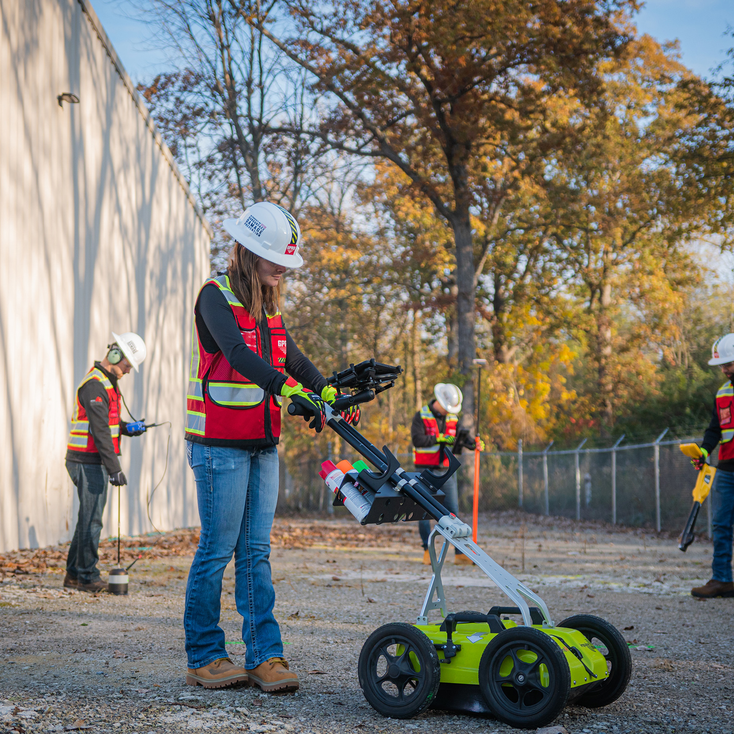
This service provided by GPRS is not limited by size. Our locating, measuring, and mapping technology allows us to completely scan any concrete structure and provide comprehensive structural analysis for a variety of sites. Be it commercial, residential, or industrial, over any surface such as concrete slabs, walls, columns, and beams, we can provide you with the most accurate, detailed results you need to ensure your project’s success.
Once the concrete scanning process is completed, a clear visualization can be rendered of the vertical and horizontal position of any existing impediments such as post-tension cables, rebar, beams, and conduit. Through SiteMap®, powered by GPRS, you are able to view any data and imaging of concrete slabs via uploaded structural drawings or even 3D models and tours. All raw data and documentation can be easily stored and referenced in our Digital Plan Room, while any maps and models from these uploaded documents can be viewed and shared in our Map Viewer feature
Features within concrete slabs such as structural and utility components are critical to identify, record, and accurately map prior to any further construction planning, coring, or saw cutting can begin. If you’re considering scheduling concrete scanning services with us, we’re here to help answer all of your questions and provide you with the best possible service to meet your project’s needs.
What Is the Accuracy of Concrete Scanning?
The typical accuracy we’ve found concerning our services is +/- ¼” to the center of the object we locate in concrete, whether it’s a conduit, post-tension cables, or rebar. With our GPR capabilities, we can also pinpoint with an accuracy of +/- 10-15% the precise depth of every object we locate within the concrete.
Since the accuracy of our GPR services is so high, we are then able to offer our professional opinion to the contractor concerning where to drill in order to avoid the risk of hitting any of the objects marked within the concrete slab.
How Long Does Concrete Scanning Take?
Not only is ground penetrating radar accurate and reliable, but it is also an extremely efficient technology, allowing large areas to be quickly scanned with ease. Our usual layout for a core drilling location is typically 2×2 ft, and it usually takes approximately 10 minutes to fully scan and mark this area size.
How Is This Data Mapped and Modeled In SiteMap®’s Geographic Mapping Software?
With the geographic mapping software of SiteMap® powered by GPRS, we can provide our customers with the detailed, accurate maps and models they need to fully visualize their site’s concrete slab components and thickness information. This can be provided through:
CAD Drawings
- A key factor to any job site’s success is communication. Our GPRS Mapping & Modeling Team is responsible for creating CAD drawings which document project results, and provide a permanent record of our findings, maintaining our 100% subsurface damage prevention goal. These drawings are then utilized by contractors and owners alike, allowing them to update any as-built drawings for planning initial strategic steps, initiating core drilling or cutting, and/or documenting site change history.
3D CAD Files
- Unlike other competitors within this space, it is our constant goal to “widen the gap” between current industry standards and our state-of-the-art services. By offering 3D mapping and modeling to document all interior findings we manage to do just that.
Our 3D CAD Drawings are able to provide clearer, up-to-date visual representations of every site. These realistic 3D CAD files document vertical and horizontal elevations, creating far more detailed visualizations than any standard 2D model.
3D Modeling
- Last but certainly not least, our modeling and walk-thru capabilities provide the ultimate form of communication through the use of our state-of-the-art 3D LiDAR laser scanners and cameras.
With SiteMap®, powered by GPRS, you can ensure your team is communicating efficiently and minimizing risk. We strive to help those looking to Visualize The Built World™ by providing high-resolution, clear maps and models of any site, empowering you to share your plans with subcontractors, designers, engineers, and others using an easy, streamlined approach.
Learn more about how SiteMap®, powered by GPRS, can provide a unique tool to help you collaborate better and completely visualize your facility in a new, innovative way.