Artificial Intelligence (AI) in Construction
Artificial Intelligence (AI) is proving applicable across a variety of industries and construction is no exception. In fact, Artificial Intelligence use within the Construction market was recently valued at 519.63 million USD, “and is expected to expand at a CAGR of 37.78% during the forecast period, reaching USD 3554.22 million by 2027.”
An example of integrating AI into construction is especially seen in site evaluations. AI can help field investigators by automating the process of digitally locating, marking, and fully mapping utility indicators marked by 811, manhole covers, power boxes, and storm drains to name a few. Be it above or below ground, AI may make the process of assessing the current landscape of your project site easier.
While it can be exciting to consider this new approach to facility visualization, the reality is that most of the GIS platforms currently available are not equipped to interface with AI, or to take on large amounts of data and provide useful, high resolution 3D maps and models facility managers can use, let alone share and constantly update across multiple project teams. Moreover, it’s important to recognize that there are still limitations of AI assessments, especially compared to the accuracy and reliability of real human boots on the ground. Here at SiteMap®, powered by GPRS, we’ve noticed out competitors in this industry touting their AI algorithms, but we show our expertise through action not just talk. This is why we’ve maintained a 99.8% accuracy rate by using elite, fully trained project managers to provide our customers with results they can trust.
Our innovative, industry-leading approach to facility management software goes above and beyond merely providing standard storage for AI-generated data. SiteMap® provides an all-encompassing, comprehensive service covering your entire site both above and below ground, and is capable of processing large data files to support projects of virtually any size. These digital tools are completely redefining collaboration, allowing you and your team to share the most up-to-date data files, maps, and models necessary for your project to stay on track. With SiteMap®, our customers are able to view their infrastructure in a way that is accurately mapped, digitally organized, and easily accessible.
This modern technology is made possible through our two key pillars of innovation; the Digital Plan Room and the Map Viewer.
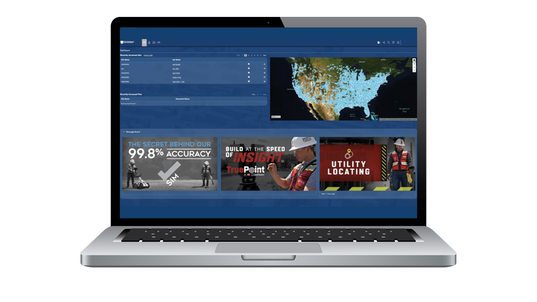
SiteMap, GPRS’ revolutionary facility management platform, provides an all-encompassing, comprehensive service covering your entire site both above and below ground.
Digital Plan Room
SiteMap®’s Digital Plan Room serves as a central repository for all necessary facility maps, drawings, models, photos, reports, and other as-built documentation. Such files are then directly linked, cross-referenced, and made viewable using the Map Viewer by appropriately tagging each document with its corresponding location information. The Digital Plan Room is a safe and secure digital storage space for all your project’s relevant facility documents, and is capable of storing large amounts of data, so that you are not limited by the size of your project. SiteMap also allows you to securely share this data with any people or teams you designate so everyone is seeing the same real-time information. This is especially useful for projects addressing municipality needs be it roads, bridges, schools, etc.
Our Digital Plan Room efficiently organizes your most important documents. We help even the most complex projects stay organized and up-to-date with their underground utility locating data, concrete scanning and mapping data, historical drawings, drone footage, video pipe inspection reports, point clouds & measurement data, and so much more.
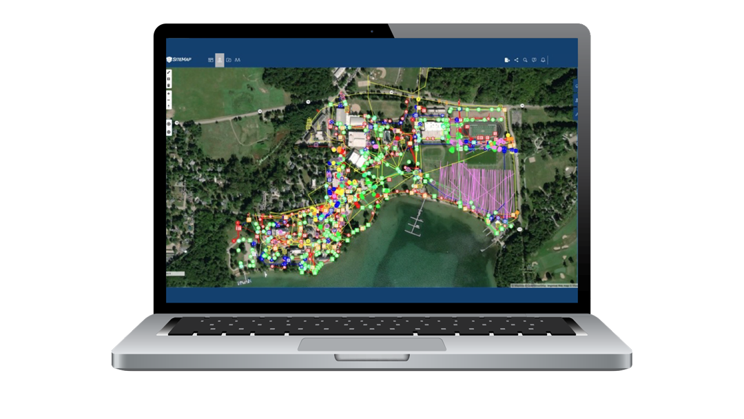
- Map Viewer
Our Map Viewer simplifies the process of viewing facility data by allowing users to connect locational data with specific uploaded documents, models, and specifications. With this feature, facility managers can then easily track and locationally designate documents so that they are readily available for future reference, and easily shareable among teams. In addition, the Map Viewer also creates a more fluid experience when sharing and updating location documents. With these capabilities, the Map Viewer is an essential tool to save time and improve overall communication across a project team.
Some unique components of our Map Viewer include viewable, searchable maps, a 3D Modeling Viewer, and tagged site features to maps such as preliminary facility or multi-site measurements and calculated estimates of length and area.
SiteMap®, powered by GPRS, is far more than just a standard GIS Platform. For those looking to transition into this modern age of digital construction, our technology greatly improves the level of communication, organization, and safety on any project, regardless of size or complexity. With SiteMap®, you can feel empowered when communicating your plans with subcontractors, designers, engineers, and others using our modern, streamlined approach.
How can we redefine collaboration for you and help your project eliminate change orders, work stoppages, damage, and cost overruns? Learn how on our official SiteMap® website, and by downloading our brochure, and contacting us for a quote today!