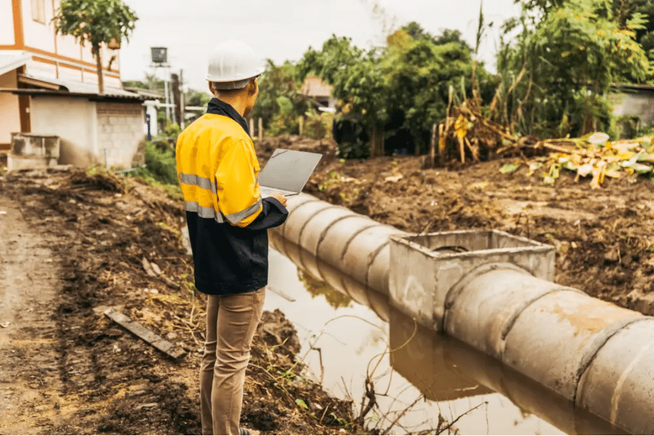
Over the past few years, there have been growing concerns about the state of infrastructure in the US. In fact, the American Society of Civil Engineers (ASCE) gave the United States a D+ rating overall after evaluating the deteriorating state of our country’s roads, bridges, transit and water systems. For this reason, construction spending, especially in the civil road & bridge sector, has been on the rise. In just the past year alone, construction in US infrastructure was estimated to be over $350 billion.
Read MoreRecent reporting by FINCH Brands found that a major pain point for many construction projects and their facility managers is that there are too many files saved/stored in various different places: some hard copies and some digital files. In fact, 62% of facility managers expressed that they are frustrated by the fact that they “have to look in many places to find subsurface utility information before breaking ground.”
Read MoreThe Common Ground Alliance (CGA) and their Data Reporting & Evaluation Committee have issued their latest comprehensive account and analysis “of damages to buried infrastructure in the U.S. and Canada” through their Damage Information Reporting Tool (DIRT) Report.
Read MoreOf the 100,000 public school facilities within the United States, 53% have reported a major need for upgrades and Renovations across their facilities, including HVAC systems, as reported by the Government Accountability Office (GAO). In addition, the 2021 Report Card For America’s Infrastructure by the American Society of Civil Engineers, the U.S. school infrastructure sector stands at a dismal D+.
Read MoreAs defined in Infrastructure Asset Management (IAM): Evolution and Evaluation, infrastructure asset management (IAM) is an emerging discipline with the goal of providing “a more systematic approach to managing infrastructure assets… enhanced customer satisfaction, governance and accountability, risk management, financial efficiency, and sustainability.”
Read MoreThe need for reliable and accurate infrastructure assessment is crucial before any updates, renovations, or new technologies are implemented to a given job site. For example, recently “a risk-free performance trial of a new autonomous bio-augmentation technology from Enbiorganic Technologies” for water treatment was successfully implemented in Silver Spring Township, Pennsylvania.
Read MoreIn Eric Too (of the Queensland University of Technology) and Linday Tay’s (of Bond University) paper, “Infrastructure Asset Management (IAM): Evolution and Evaluation,” infrastructure asset management (IAM) is defined as an emerging discipline which aims “to provide a more systematic approach to managing infrastructure assets.”
Read MoreNatural disasters can cause and reveal existing infrastructure damage. Be it from intense hurricane flooding, tornadoes, earthquakes, ect.; cars, boats, and even homes can be displaced for hundreds of miles. As a result, these disasters leave in their wake damaged water pipes, utility lines, and much more.
Read MoreThe backlog of construction projects has reached its highest level since 2019, according to recent reporting. Since the second quarter of 2019, construction backlog reached its highest reported level “as contractors with under $30 million in revenue landed new jobs faster than expected, according to Associated Builders and Contractors.”
Read MoreThe restaurant and retail industries are continually upgrading and updating their facilities in response to trends like eCommerce and curbside pickup. These renovations and upgrades often require excavation, or concrete cutting and coring. GPRS locates, maps and models can ensure accuracy and prevent damage during the renovation of shopping/retail facilities, restaurants, warehouses, and private offices.
Read MoreSiteMap®, powered by GPRS, provides 3D laser scanning, mapping, and modeling services using modern TruePoint 3D Laser Scanning technology. These services are applicable across a wide range of industries, improving measurement quality and accuracy, expediting communication, reducing manual labor, and minimizing unnecessary costs and change orders.
Read MoreGPRS Utility Locating Services ensure that onsite mapping of buried utilities is comprehensive and accurate before storing and modeling interactive maps on the SiteMap® platform. While the One Call system (811) marks publicly-owned utilities, almost any construction project will also involve some privately owned utilities.
Read MoreRecently FINCH Brands, a premier consumer insights firm, performed a large-scale survey of qualified respondents within the construction industry. All 110 respondents were responsible for making capital expenditure decisions for their facilities and managed one or more building projects across multiple sites.
Read MoreThe popularity of renovating older buildings in US cities reached a record high in the spring of 2022, with “the majority of architecture firm billings [coming] from renovation work, not new construction,” according to the American Institute of Architects (AIA).
Read MoreRegardless of the type of construction project at hand, the three most important goals always set are to stay on time, on budget, and safe throughout the entire process. Using our SiteMap® services powered by GPRS, you can rest assured that when drilling, cutting, or coring through a concrete deck, you’re empowered with accurate data and evaluation results which are backed by GPRS’ Green Box Guarantee
Read MoreFINCH Brands, a premier branding and consumer insights firm, recently conducted a research study on our SiteMap® services. This research focused on identifying the pain points of today’s facility management consumers, and how our modern approach to construction successfully addresses them.
Read MoreHere at SiteMap®, powered by GPRS, we can deploy state-of-the-art Utility Locating Services leveraging the most advanced, industry-leading equipment to perform detailed inspections for our customers. Be it for a public or private property project, our unmatched nationwide service network will easily connect you with an expert Project Manager who can reach your location within 24 to 48 hours of contact to help you solve any of your particular utility locating needs.
Read More3D laser scanning is an innovative, modern, and efficient tool for mapping and modeling a variety of project areas. Its time-saving and cost-minimizing approach to measurement avoids unnecessary change orders and rework.
Read MoreFor any project, be it commercial, residential, or industrial, it is crucial to properly maintain all your facility’s required permits. Failure to perform proper inspections or even the misplacement of their crucial data files can result in major project delays and unexpected additional costs.
Read MoreAs defined by the Lean Construction Institute, Lean Construction is a process of project delivery and execution which relies on “methods of maximizing stakeholder value while reducing waste by emphasizing collaboration between teams on a project.” The key goal of this practice is to “increase productivity, profits, and innovation in the industry.”
Read MoreThe National Association of Sewer Service Companies (NASSCO), establishes the industry standard for evaluating the current conditions, rehabilitation, and maintenance for all underground infrastructures within the United States.
Read MoreIn a recent article published by Autodesk Inc., 3D laser scanning, “also known as high-definition surveying (HDS) or reality capture,” was described as a “means of using a laser to map an area with high accuracy,” for a given construction project. 3D laser scanning and mapping methodologies are commonly used to capture the most accurate and detailed data, accounting “for every nook and cranny on a site.”
Read MoreAs defined by Perry Testing Ltd, concrete scanning is “the process of scanning concrete using one or more forms of non-destructive technology.” This kind of site evaluation can utilize a number of tools such as cover meters, a ferroscan instrument, ultrasonic scanning equipment, and/or ground penetrating radar (GPR).
Read MoreConsidering any construction or mapping project through a technical lens can provide numerous benefits, streamlining processes being chief among them. However, in today’s construction industry, there is a typical documented disconnect among the parties involved, and a lag in the adoption of new technology that can remedy the divide.
Read MoreA Geographic Information System (GIS) is a data processing system which is used to collect, analyze and present geospatial data by combining on-site measurements, technology, software, and GPS. GIS platforms allow customers to leverage digital construction tools in order to evaluate and display useful reports and models of spatially referenced data.
Read MoreGeographic Information Systems (GIS) are reinventing the way industrial designers are Visualizing the Built World™ by combining data, technology, software, and GPS to model and analyze spatially referenced data. These digital systems of viewing maps provide a more modernized, efficient approach to project planning and execution.
Read MoreCloud-native geospatial mapping is the modern standard for data storage, offering a way for facilities, construction, and engineering teams to access data at any time, from anywhere. When your maps, permits, and site data are scattered, compiling them into one centralized repository can instantly streamline your construction, renovation, and maintenance projects.
Read MoreLocation intelligence is achieved via visualization and analysis of geospatial data. It is powered by geographical information systems (GIS) that allow users to store their geospatial data in real time to gain insights on their business. GPS and GIS technologies allow for the collection of data from roads, city infrastructures, vehicles, and different locational platforms.
Read MoreModern Geographic Mapping Software is revolutionizing the data visualization capabilities available today. Through the combination of innovative data capturing methodologies and geographic information systems (GIS) technology, geographic sites can be fully scanned from top to bottom to render useful, high-resolution maps and models.
Read MoreInfrastructure mapping can be described as the study of physical connectivity on different networks. It is a process of detailed maps that help to visualize your network and is essential for prevention of damage to facilities.
Read MoreCloud-based GIS (Geographic Information System) data storage infrastructure comes with numerous benefits over traditional storage on local drives. An understanding of GIS will clarify why cloud data storage is the optimal choice. Geospatial technology “is a term used to describe the range of modern tools contributing to the geographic mapping and analysis of the Earth and human societies,” according to the American Association for the Advancement of Science (AAAS).
Read MoreInfrastructure asset management is the process of managing physical assets such as buildings, roads, and bridges. It includes activities such as planning, design, construction, operation, and maintenance.
Read MoreManaging the integrity of all aspects of your facilities, both above and below ground, can be an impossible task if your data is decentralized and outdated. Interactive maps bring order to chaos, expertly combining the layers of your geospatial data. In turn, this analysis can be used to understand the current state of your building or campus, tracking the location and condition of numerous components. It can also help you to plan for future construction projects, while providing your employees and patrons with a safe environment.
Read MoreInfrastructure planning is a critical but often overlooked aspect of city planning. In order to ensure that all aspects of a complex facility run smoothly, its infrastructure must be well-designed and properly maintained. One of the best ways to achieve this is through 3D utility mapping.
Read MoreYour campus—whether comprised of offices, university halls, or factory buildings—can sharpen its utility management strategy through the use of 3D utility mapping technology. There are efficiencies to be gained by electronically connecting the utility data across your sprawling property, and the experts at SiteMap can help you navigate this modern process to promote employee safety, conserve resources and costs, and confidently meet your construction deadlines.
Read MoreSiteMap technology is cutting-edge and uniquely able to combine site data, both above ground and subsurface. Parent company GPRS uses GIS, or a geographic information system, to combine geospatial information from the smallest building and utility feature to the largest swaths of your geographical footprint. This data is subsequently displayed in SiteMap’s user-friendly Map Viewer interface.
Read MoreThe use of drones, or unmanned aerial vehicles (UAVs), is reshaping the way that geospatial infrastructure mapping collects site data. Not only can this technology be used on construction sites, it is easily applied to school and campuses, hospitals, office complexes, and property across a wide variety of terrain.
Read MoreIn a recent study of facility managers commissioned by GPRS, it was reported that two-thirds of facility managers have experienced campus damage due to a utility strike or other locating issue. What’s more, 50% of those managers reported miscommunication and inaccurate data as the primary sources of accidental project damage. Each damage event resulted in 2-3 months of downtime, and an average of $56,000 in cost.
Read MoreGPRS is providing our 99.8% accurate utility locating and mapping to UToledo’s campus in exchange for field training for our Project Managers
Read MoreCulver Academies aim is to serve their students steadfast and boldly. Their purpose is to provide students with the best whole person education in the country. To fulfill this purpose, Culver must uphold the mission, principles, and values that have made their school, community, and their student body successful since the founding days of the academy.
Read MoreSiteMap, powered by GPRS, allows facility managers to view underground utility networks and hidden construction, reduce engineering risks, and build a 3D map to aid surface and subsurface construction projects.
Read MoreGround Penetrating Radar Systems, LLC (GPRS) is releasing a new software and service named SiteMap. This new service offering will be the first of its kind in the private subsurface locating industry.
Read More