Culver Academies aim is to serve their students steadfast and boldly. Their purpose is to provide students with the best whole person education in the country. To fulfill this purpose, Culver must uphold the mission, principles, and values that have made their school, community, and their student body successful since the founding days of the academy.
However, to serve their students and community, Culver must first ensure the safety of its students and faculty.
This is where GPRS comes into the fold.
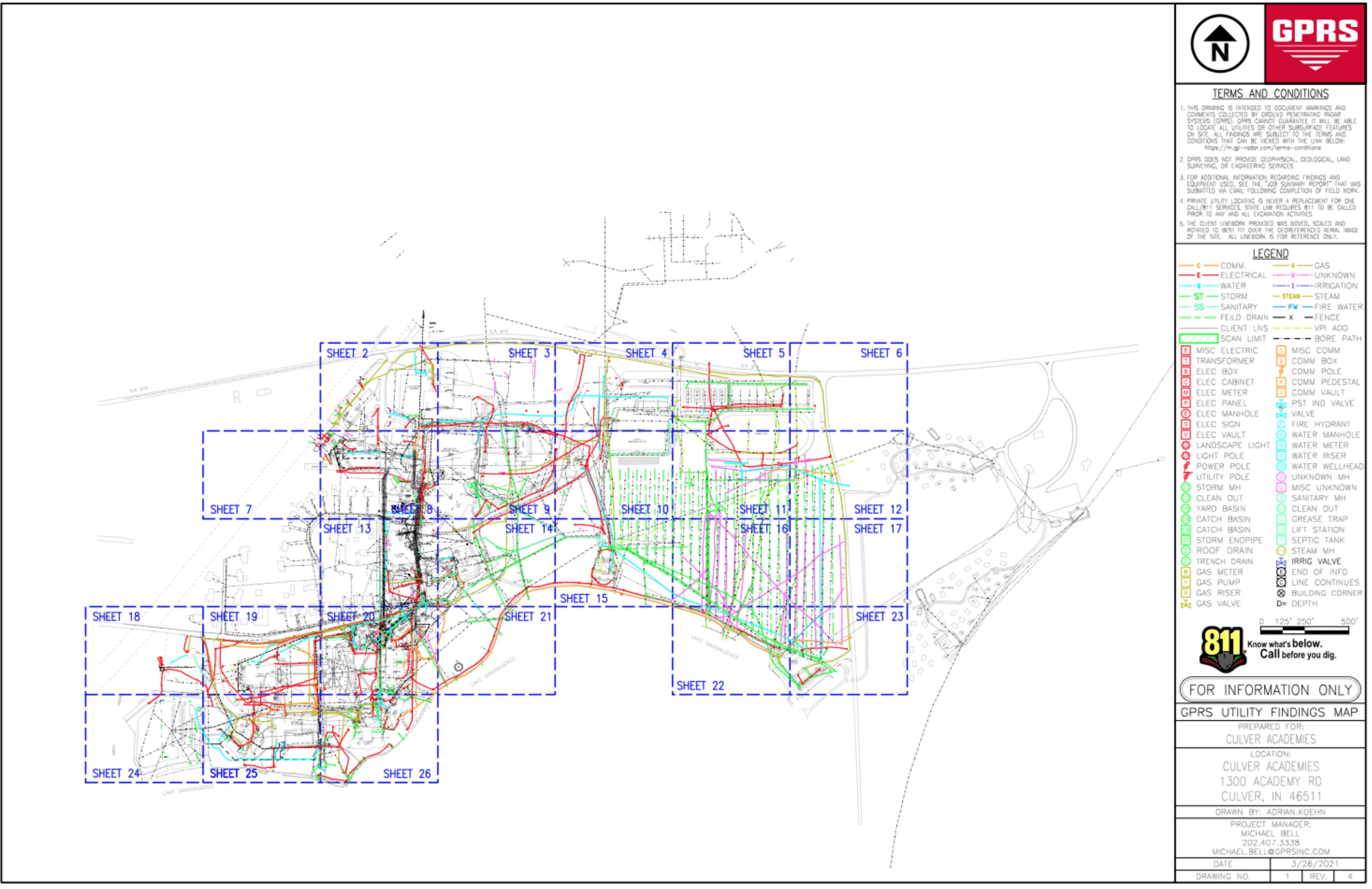
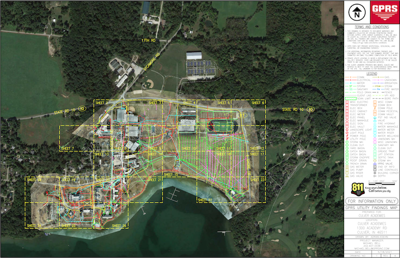
In the past, GPRS has conducted utility locating services for Culver Academies. Considering that Culver has a complex set-up of underground utilities, they’ve often needed our company to scan and mark locations using our advanced ground penetrating radar and electromagnetic (EM) technology. However, per each project, it’s almost impossible for GPRS to find every underground utility that Culver contains. Therefore, for a campus as large as Culver, it would typically take multiple projects to detect and mark each underground utility.
Additionally, GPRS CEO, Matt Aston, has a current relationship with Culver Facilities Manager, Jeff Kutch. After a conversation discussing their issues detecting and discovering all their underground utilities, Matt and Jeff realized how they could help each other, and solve the ongoing issues of utility line strikes and record retention.
That solution is SiteMap.
SiteMap (powered by GPRS), is a cloud-based digital platform, designed to be used as an easy-to-use portal, containing your brand-new, accurate, and up to date “as-built” drawings all in one place. Designed with an intuitive user-interface, SiteMap delivers permanent records of site assets and infrastructure knowledge, allowing for safer excavations, and saw cutting and core drilling projects.
Additionally, SiteMap makes GPRS’ facility mapping and modeling easier by granting clients the ability to get organized. You know longer have to worry about record drawings being stored in multiple locations, inaccurate record drawings, or knowledge of your site only being stored in an employee’s brain. SiteMap gives you project infrastructure information and data, quick and easy.
Now, what makes Culver Academies a perfect candidate for SiteMap?
Culver Academy boasts an older, extensively large campus with a lot of utilities underground, which have been continuously changed due to years of expansion and rebuild. With an older institution such as Culver, most current recordings are outdated or inaccurate. SiteMap is all about creating accurate visuals for your facility, and transferring those records into digitalized versions, before storing them into the web-based platform to organize them for future use. Culver was the perfect candidate because GPRS not only could update their existing facility maps but help store them safely in a place that could always be accessed. That way if Culver decides to act on any expansion or rebuild plans, they already have an accurate mapping of their facilities to begin excavation, in a safe and protected environment.
To help solve Culver’s problem, GPRS conducted utility locating, EM locating, and ground penetrating radar services to determine the locations for Culver Academies’ underground utilities. By beginning with a utility locating search, GPRS is able to provide Culver with an accurate detail of their underground workup, granting them a permanent record for safekeeping.
This record not only helps prevent future line strike damages, but Culver can use our maps for future designing and planning, minimizing change orders from contractors, and anything else related to their facility. In addition, as a part of SiteMap, GPRS conducted a sample Matterport scan of the entire main building to help build a physical twin, which will eventually link to the rest of the map as well.
Like most project sites, there were hiccups during the process. Issues with PVC water lines, which are typical for a utility locating project, made it difficult for them to track down all underground utilities and mark them. Beyond traditional locating methods, GPRS decided that for a project this large, a new method should be introduced.
Once the snow melted around campus, GPRS supervised the use of a drone to help scope out the entire campus. In addition, we attached a radar scanner on the back of an ATV to help cover the scope of the large area, accurately marking where each location was, utilizing geotagging GPS to pinpoint each underground location.
With a location this large, there are variants that arise during the process of utility locating. Although the project hasn’t finished, project managers are finding new and inventive ways to provide Culver with plans for their facility that they can own and keep. This process not only provides them with such but saves them time and money down the line when they need to dig underground.
New academic buildings, baseball fields, parks, anything you can imagine young adolescences need for their educational journey, Culver can provide with the facility maps GPRS conducts and creates.
GPRS is here to provide any company, facility, or organization with the opportunity to partake in SiteMap. We’re in the business of safety, and there’s no shortage of projects to help us reach our 100% damage prevention goal!